Table of Contents:
1. A Town with a UNESCO Global Geopark “Samani Town”
2. A flower mountain with alpine plants in full bloom “Mt. Apoi area”
3. Cape Enrumu and strangely shaped rock art “Samani coast area”
4. Precipitous Cliff Scenery “Hidaka Yabakei Area”
5. Autumn Leaves and Fishing “Horomankyo Area”
6. Geology traveling from the southern oceans and Samani’s cherry blossoms “Shintomi area”
A Town with a UNESCO Global Geopark “Samani Town”
An introduction of Samani Town from a locational and climatic standpoint
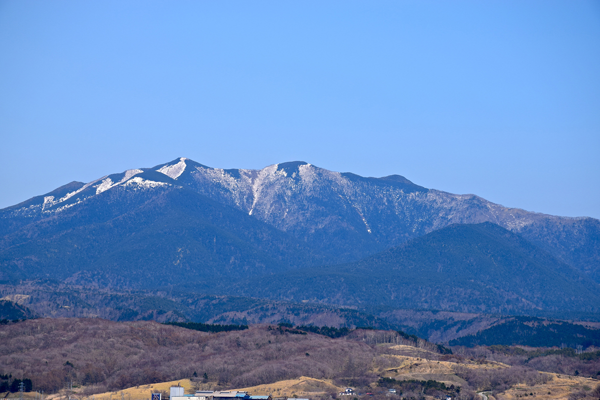
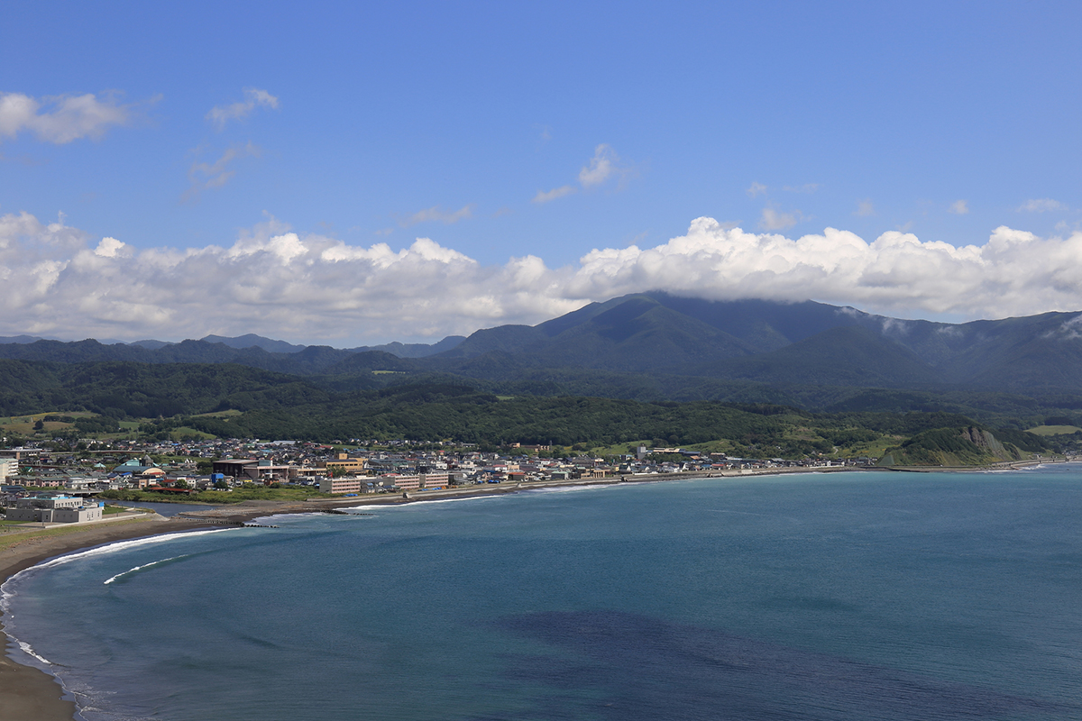
Samani Town is in the Hidaka region of Hokkaido with rigid mountainous areas, located just southeast of the Hidaka Mountain Range. Because the town was set up with the Hidaka Mountain Range in the background, over 90% of the town is occupied with forestation, majestic mountain shapes, strangely shaped rock formations and cliffs that continue along the coastline creating a picturesque and distinct characteristic.
The summers are cool and the winters are warm and because it faces the Pacific Ocean, the amount of snowfall is low making the area a comfortable place to spend time. It’s about a 3 hour drive from the New Chitose Airport and about a 2 hour drive from the Obihiro Airport.
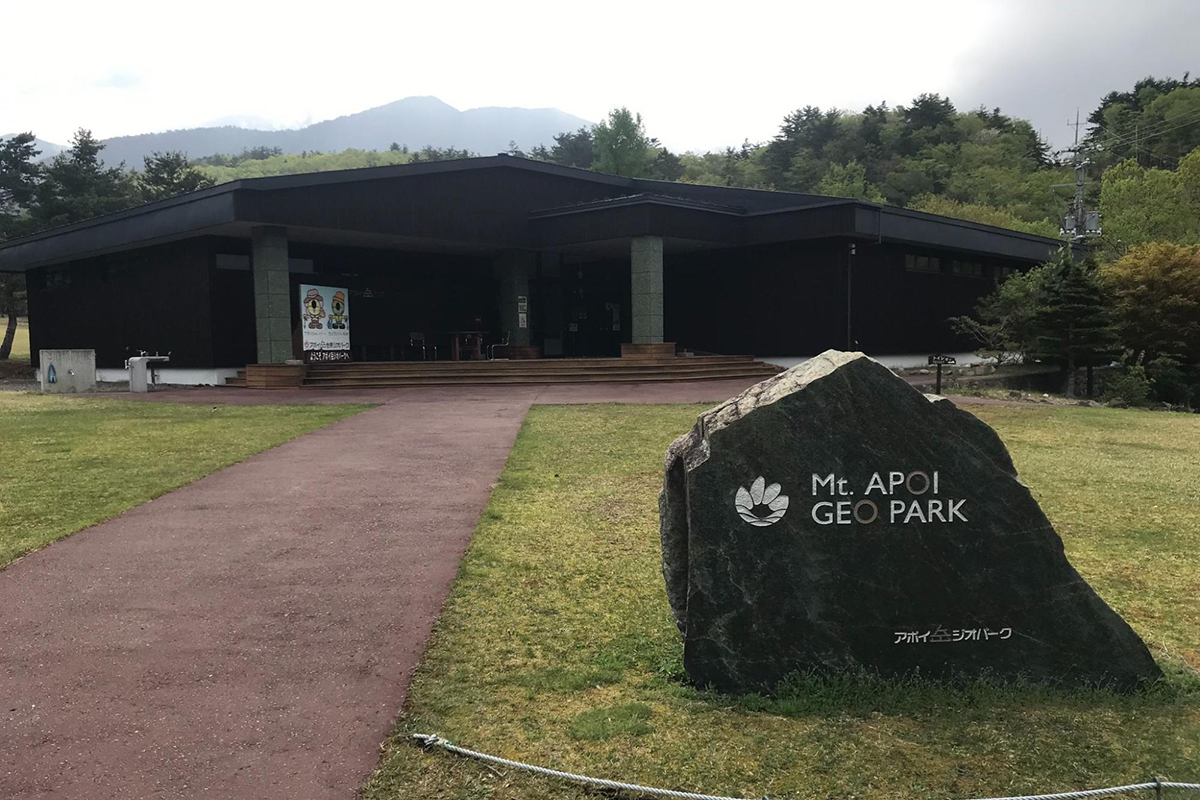
The Pride of Samani Town: UNESCO Global Geopark “Mt. Apoi”
Samani Town takes great pride in the fact that it was designated as a UNESCO Global Geopark in 2015 “Mt. Apoi Geopark (Mt. Apoi UNESCO Global Geopark).” To simply explain, a Geopark is a region with scientific value and a natural park with beautiful geological features and terrain. The UNESCO Global Geopark is a UNESCO official enterprize with over 200 designated sites around the world. Japan has a total of 10 designated sites with only 2 in Hokkaido, Mt. Usu in Lake Toya and Mt. Apoi.
Mt. Apoi’s main theme is that “the gifts from the depths of the earth are connected to the ground, nature and legends of the people.” You can feel the legends of Mt. Apoi in 5 areas around the region through the “geology,” “vegetation” and “people.”
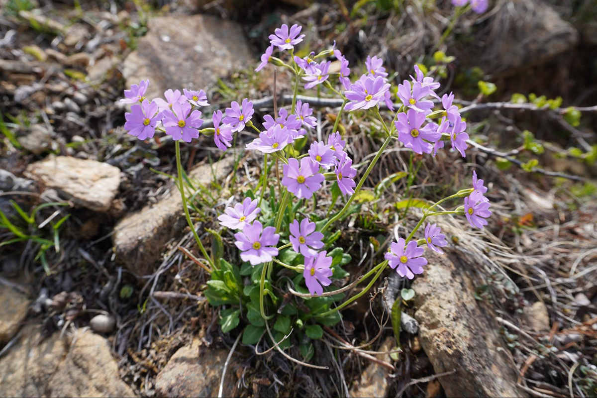
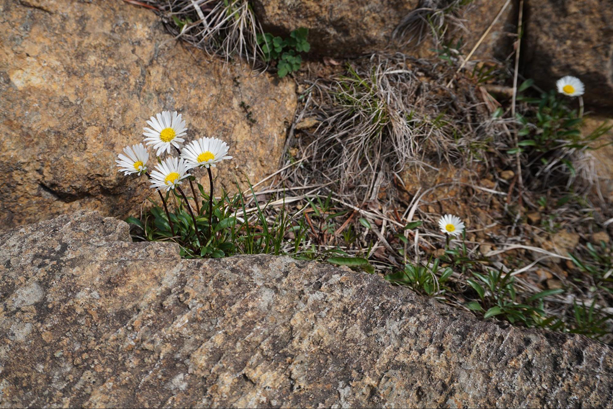
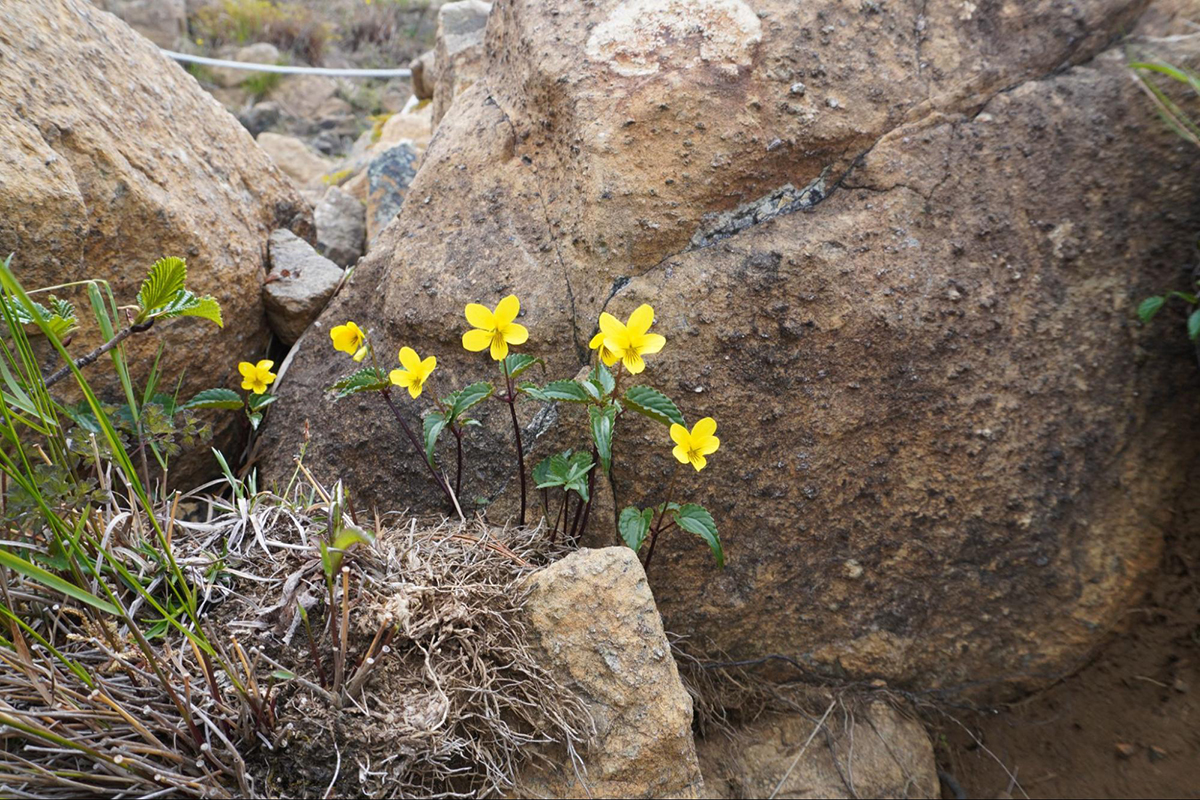
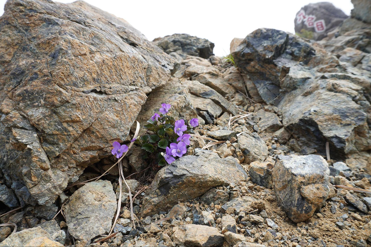
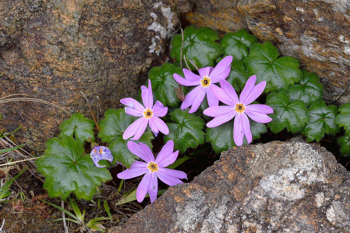
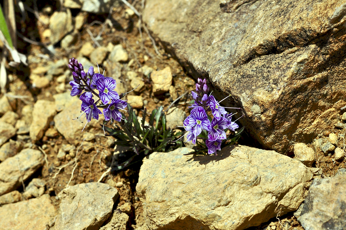
The symbol of Mt. Apoi Geopark is that despite the quite low elevation of 810 meters at the mountain tops, the alpine plants grow abundantly. Furthermore, there is a high density of endemic species, making it a rare region in the world. Mt. Apoi is a popular spot as you can easily view alpine plants. Every year, many tourists visit the area wanting to see the lovely flowers in season and the endemic species of Mt. Apoi. From the end of April through the beginning of October, the alpine plants blooming seasons differ like a kind of relay, there is never a dull moment with flowers blooming one after another. It is also said that the length of the alpine plants flowering season is quite rare for Japan.
Furthermore, fresh peridotite can be seen at Mt. Apoi, making it a precious place for the scientific community. “Fresh,” meaning that the rock composition has not gone through metamorphosis. Every year, many researchers from all around Japan and abroad visit the area in order to document information left by the mantle of the earth’s interior. The fresh peridotite of Apoi, the magma creation and the rising movements are regarded as extremely beneficial for research, internationally known as “Horoman Peridotite.”
Introducing a summary of Samani Town from a cultural and historical standpoint
From a cultural and historical standpoint, Samani Town overflows with attractiveness. One reason is that many traditions and legends of the Ainu are still present. You’ll get to know a part of Ainu culture especially from the legends of the “Parent and Child Rock” formations and other strangely shaped large rocks as well.
“Cape Enrumu,” located on the coastline of Samani was a very important port for the “Ezo”(Hokkaido’s old name) area long ago. The port has played a big role in contributing to Samani’s development. On the other hand, because of Samani’s characteristics and rough terrain, there were many rough traffic areas on the land route, as well as a need to prevent danger for people hurrying across the ocean. In order to do away with the perilous pass, a detour route was constructed called, “Samani Mountain Road.”
In the Geopark area, a footpath tour was established to follow the history of Samani Town. Please participate in this tour and experience the former earth and old legends of the people.
Of course, there are other ways to enjoy Samani Town other than the Geopark. For example, fishing, surfing and viewing autumn leaves. Ocean fishing is especially nice as the entire coastline of Samani Town is in the Hidaka region, which is known as one of the best fishing areas. You can also enjoy fishing for salmon in the fall. Furthermore, Samani Town is known as an exclusive surfing area, even attracting foreign surfers during the prime season who are looking for clear waters and beautiful scenery.
Furthermore, you can enjoy beautiful Japanese scenery at a good place not many people know about where you can see some of the vital aspects of the four seasons in Japan, such as the autumn leaves and cherry blossoms. We especially recommend viewing the autumn leaves at Horomankyo and cherry blossoms at the Samani Damn campsite area. Both of these places aren’t very well known, even within Hokkaido.
Although the harvest amount is low, great quality kelp can be harvested in the area. Mitsuishi kelp is the local specialty and can be found at the local shops. Even within the Hidaka area, Samani Town’s seashore is known for having excellent quality kelp so be sure to have a look inside one of the shops.
Just like that, you can make various travel plans for your trip without being limited to just the Geopark, which is one of the great points of Samani Town.
A flower mountain with alpine plants in full bloom “Mt. Apoi area”
Nature and Mt. Apoi’s alpine plants
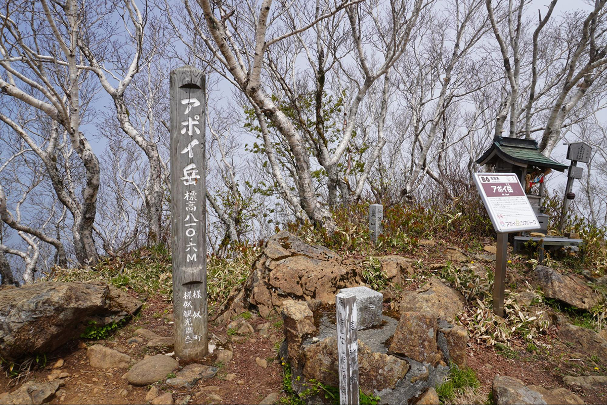
Introducing Mt. Apoi, the symbol of Mt. Apoi Geopark. Although the elevation of Mt. Apoi is quite low at 810 meters, alpine plants grow and bloom abundantly making it quite a peculiar area.
It’s astonishing that there are around 80 kinds of alpine plants growing in the area, and over 20 of them are considered endemic species (including subspecies, mutations and variants). It’s quite a rare place in the world to have such a concentrated area of endemic species, which is why the endemic species are specifically named after the area, “Apoi◯◯” and “Samani◯◯.” Other than alpine plants, there are also other precious living creatures living in the area, such as Apoi Maimai (snails) and Pyrgus Malvae (a kind of butterfly that only lives around Mt. Apoi). Let’s try finding them.
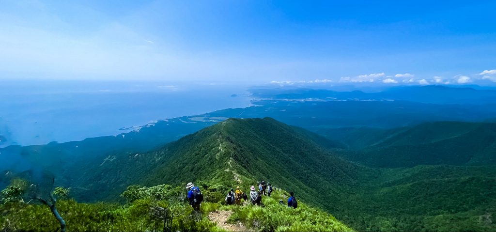
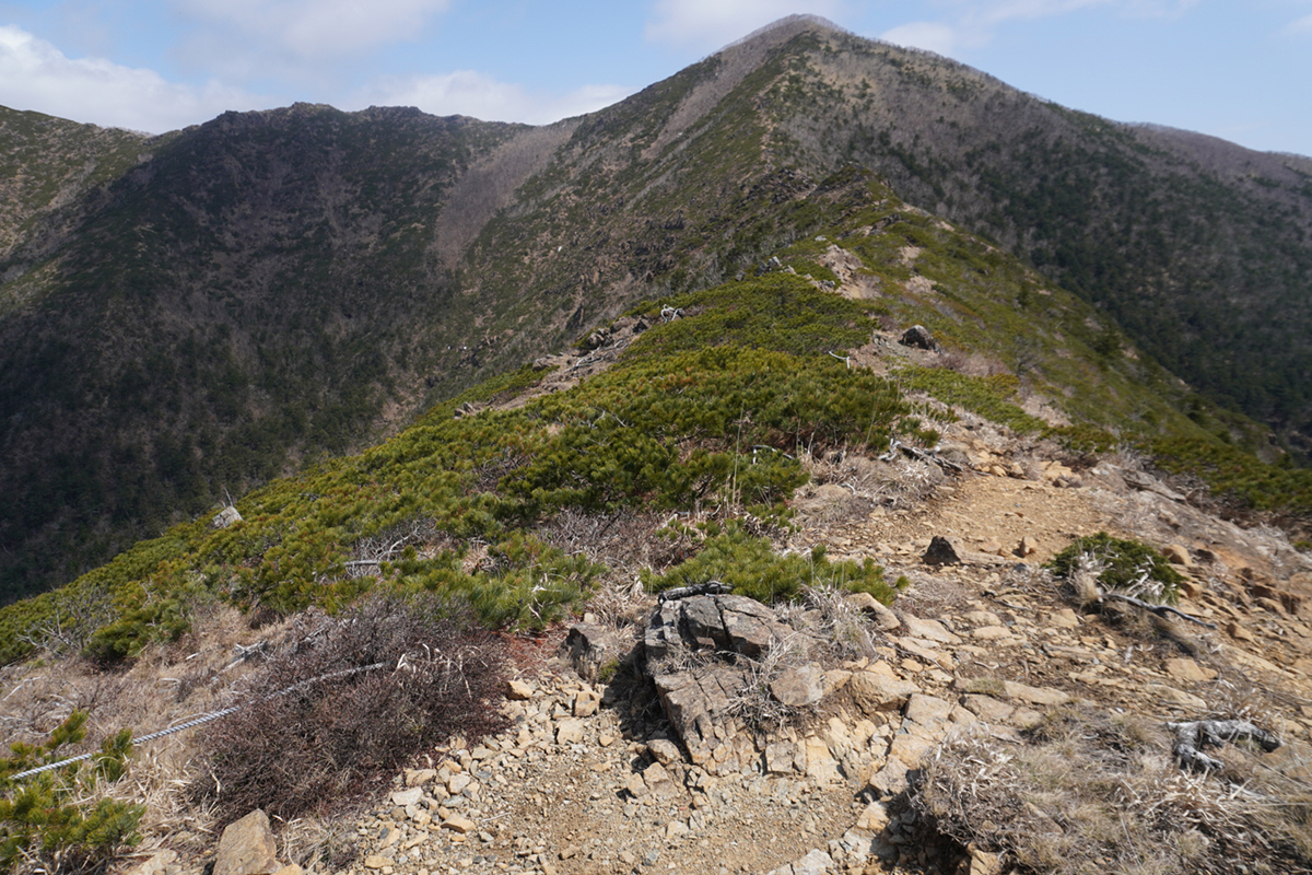
In order to climb Mt. Apoi, some stamina is needed as there are some steep climbing zones (a round trip can be completed anywhere from four and a half to six hours). However, along the way there are lovely attractive flowers that will surely take away any feelings of tiredness.
Next, we would like to introduce a summary of Mt. Apoi’s mountain climbing course.
【Stations 1~5】
・Proceed on a mountain climbing trail mixed with needle-leaved trees and broad-leaved trees.
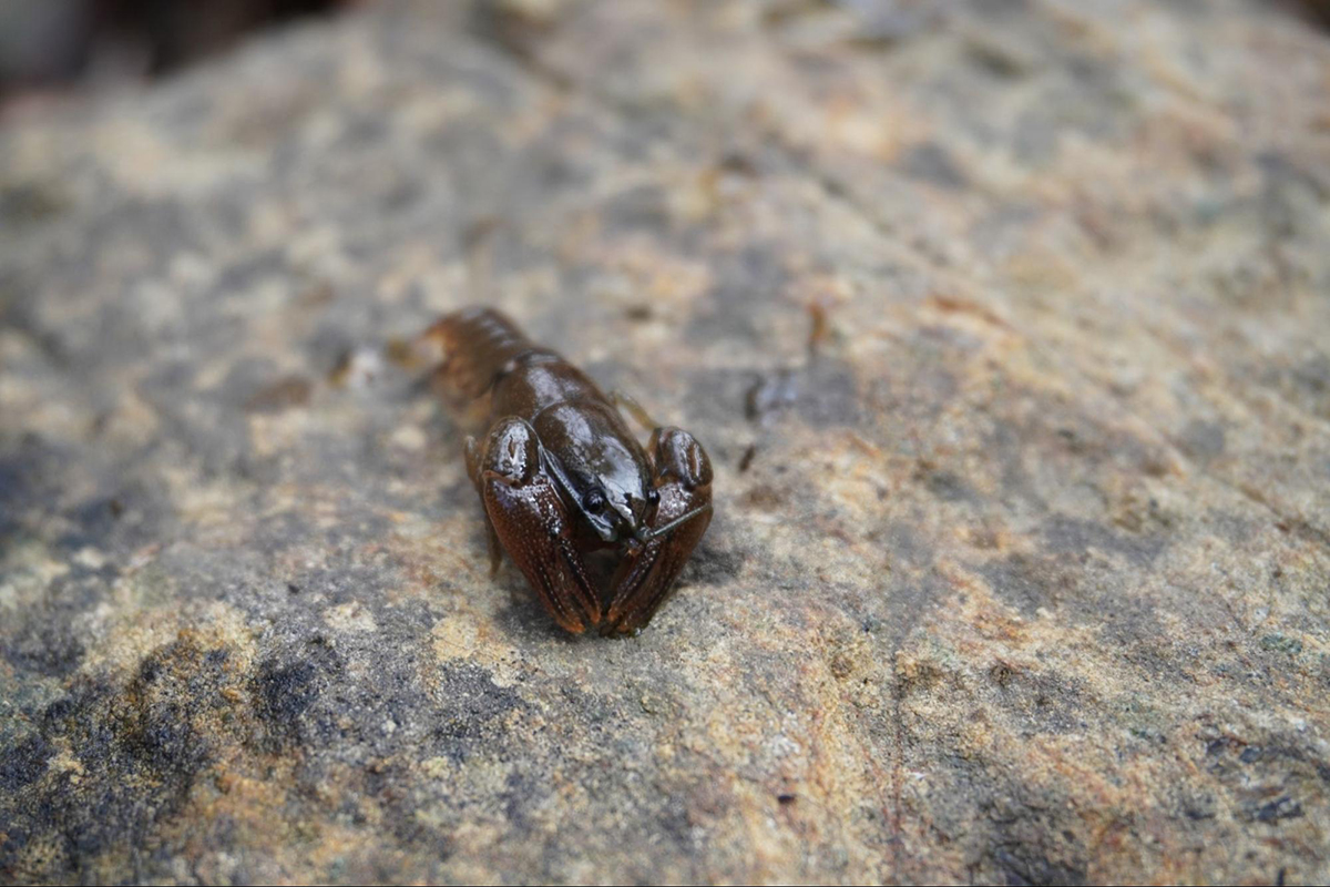
・There is a river that inhabits Japanese crayfish. However, make sure to be careful as they are considered an endangered species.
【~ 8th Station】
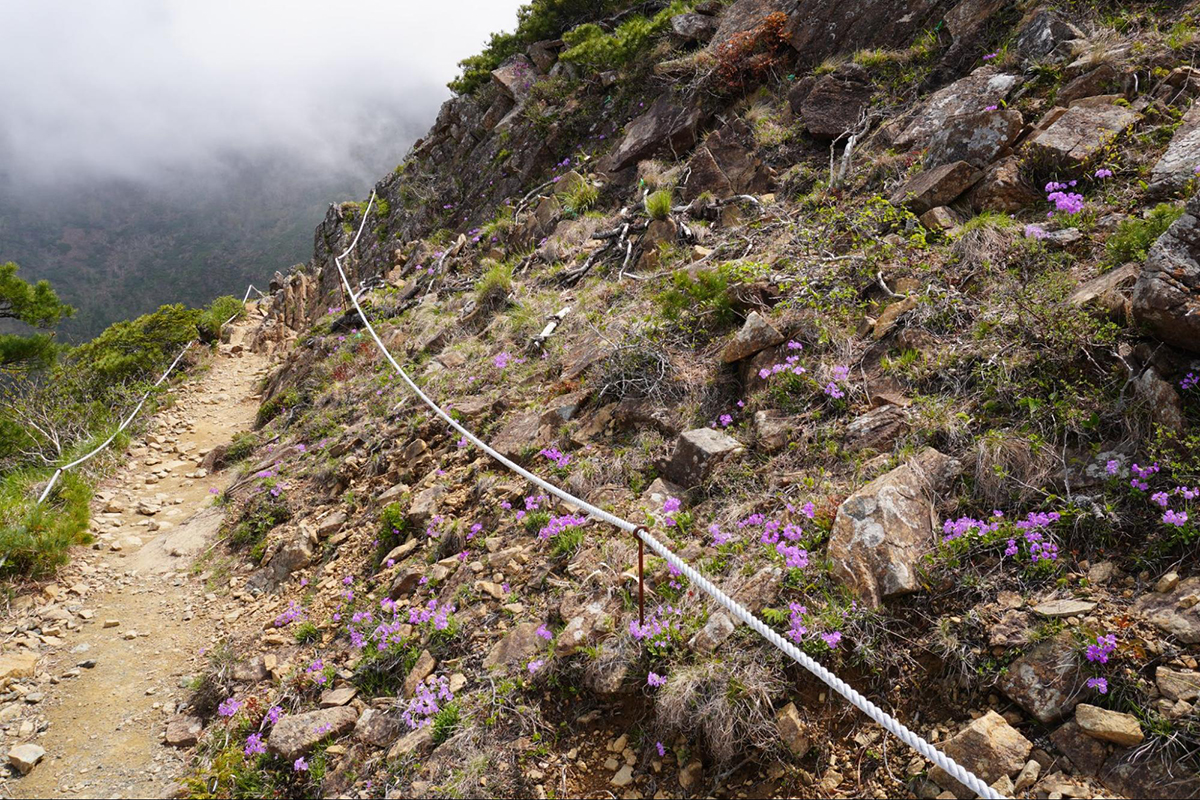
・Watch your step when climbing rocky areas.
・Around the 7th station, you’ll surpass the forest line.
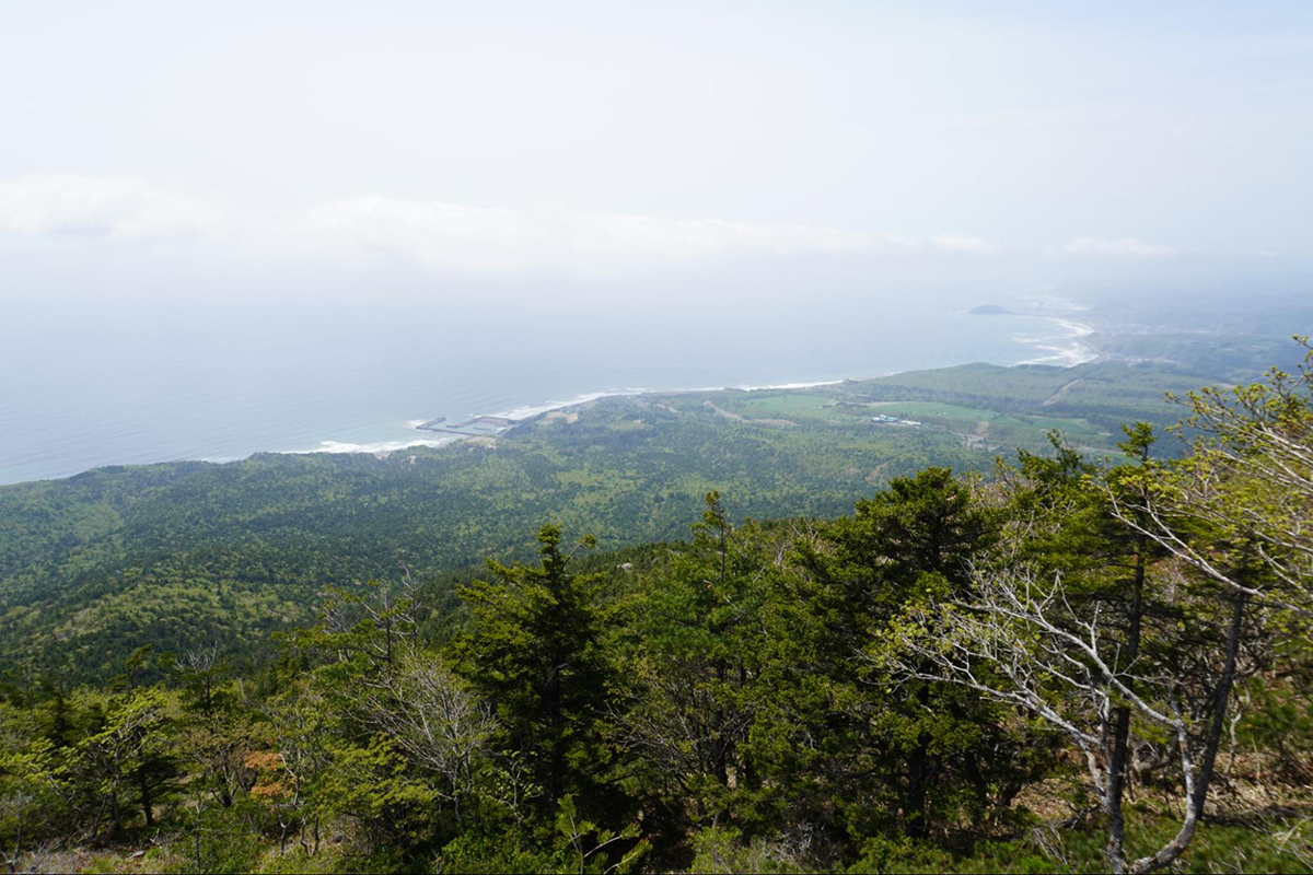
・We recommend taking a snack break near the Umanose flower fields while overlooking the Hidaka Mountains.
・As you climb up the rocky areas, you can enjoy a nice panoramic view of Cape Enrumu, Parent and Child Rocks and the Pacific Ocean that will surely take away any feelings of tiredness you may have from your climb.
【~ 9th Station】
・You will climb a steep rocky area but will surely find peace overlooking the lovely flowers from the shade of the rocks.
・Please be careful not to step on plants that may be hard to see on the uneven trail.
【The former Horoman flower fields】
・You can see Cape Erimo if the weather is nice.
Mt. Apoi’s peculiar environment is very interesting and mysterious, and even now not fully understood. If you’re interested in the details, please have a look at the summary below.
① The Japanese stone pines can be seen at around an elevation of 300 meters.
・It’s actually quite unusual for these trees. As for other mountains in Hokkaido, the usual elevation to see Japanese stone pines is over 1,000 meters, and over 2,000 meters for other mountains on the mainland of Japan.
② The summit of Mt. Apoi is covered with Erman’s birch trees and other trees and shrubs.
・Although the tree line forest starts from around the 7th station of the mountain, the Erman’s birch trees and other shrubs are growing even at the peak.
You can understand the peculiarity of Mt. Apoi from the following mystery.
Mt. Apoi’s rare vegetation is designated as “Mt.Apoi’s cluster of alpine plants,” the country’s special nature monument. There are 6 points that make it designated as a special nature monument within Hokkaido.
When traveling to Samani Town, please try climbing Mt. Apoi once. Beautiful flowers and magnificent scenery will definitely make for great memories.
The reason why alpine plants can grow at a low elevation on Mt. Apoi
There are thought to be 2 primary factors as to why alpine plants can grow on such a low mountain.
First, is the effect of Mt. Apoi’s peridotite formation. Peridotite creates soil with insufficient nutrients and the rocky areas composed of magnesium hinder plants from growing. It’s thought that because of this environment, the alpine plants became able to grow and spread like plants on flatland environments.
Second, is the climate conditions. Mt. Apoi has distinct traits of having low summer temperatures and being quite a foggy area as it’s located near the ocean. It is also thought that in addition to having low snowfall, the strong winds of winter sweep the grounds creating a harsh environment that resembles high-altitude areas.
Due to this rare combination of conditions, Mt. Apoi has an environment similar to that of high-altitude regions and can inhabit many alpine plants despite being somewhat of a low mountain.
Enjoy the flowers and panoramic view of Pinneshiri to the fullest
If you happen to have some flexibility in your itinerary plans, we recommend trying another mountain that can be seen off in the distance after climbing Mt. Apoi called, “Pinneshiri.” It would be a climb with quite a high hurdle, as the journey takes as long as 8 hours, making it a course that requires the stamina of intermediate levels and above. The climb would also require at least 2 cars to be involved.
However, in addition to being able to see many clusters of alpine plants off in the distance of Mt. Apoi, there is also an incredible panoramic view. Above the hardship, the experience is definitely worth the challenge.
An ideal mountain climbing trip for someone who enjoys mountain climbing and plants.
Stretching out in the distance, there are places in the mountain trail that are unclear, which is why we think it’s best for beginner hikers to not hike alone and to request a guide who is well-informed with the trail for protection.
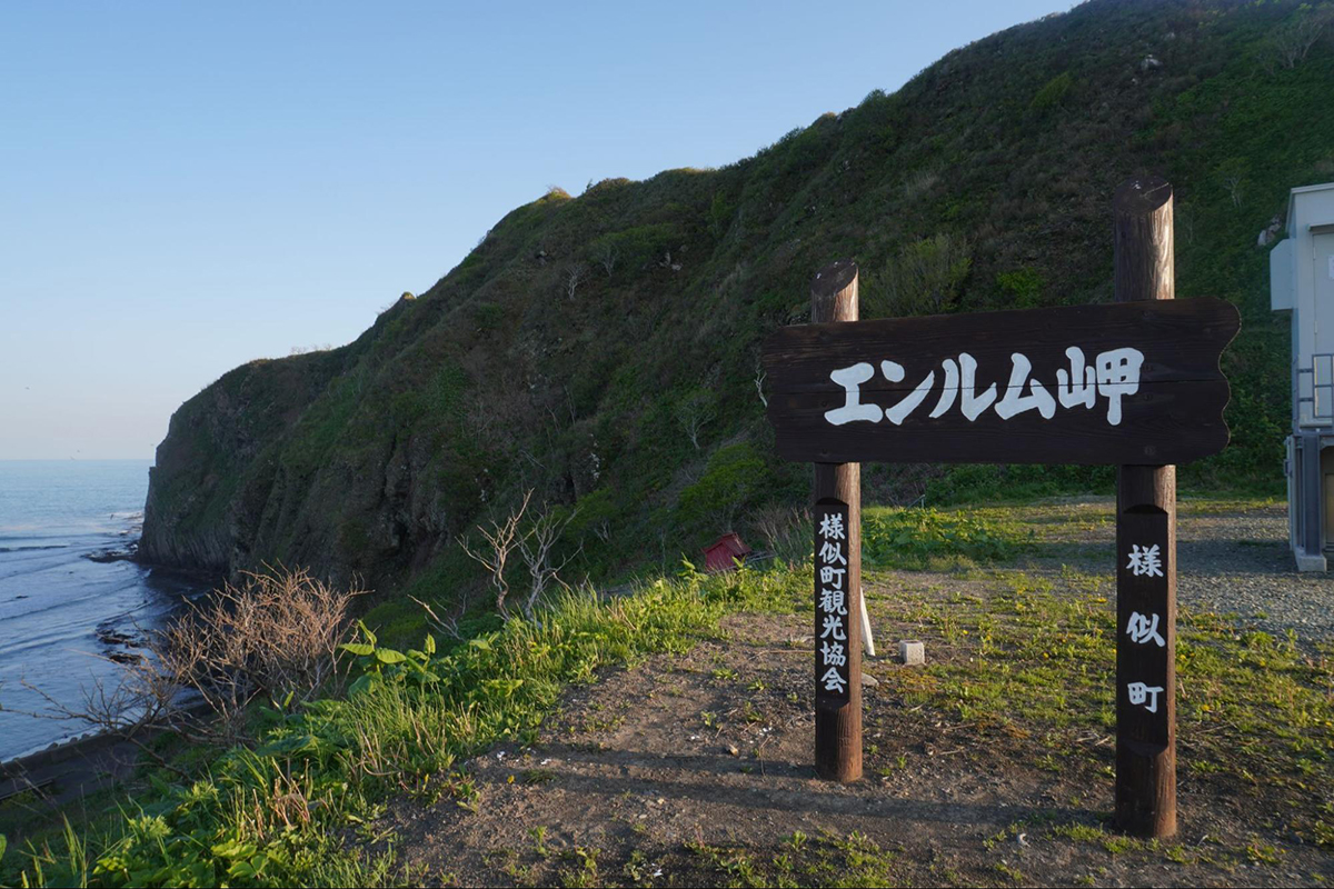
Cape Enrumu and strangely shaped rock art “Samani coast area”
The Kannon Mountain Observatory and Cape Enrumu overlooking the Apoi mountain mass
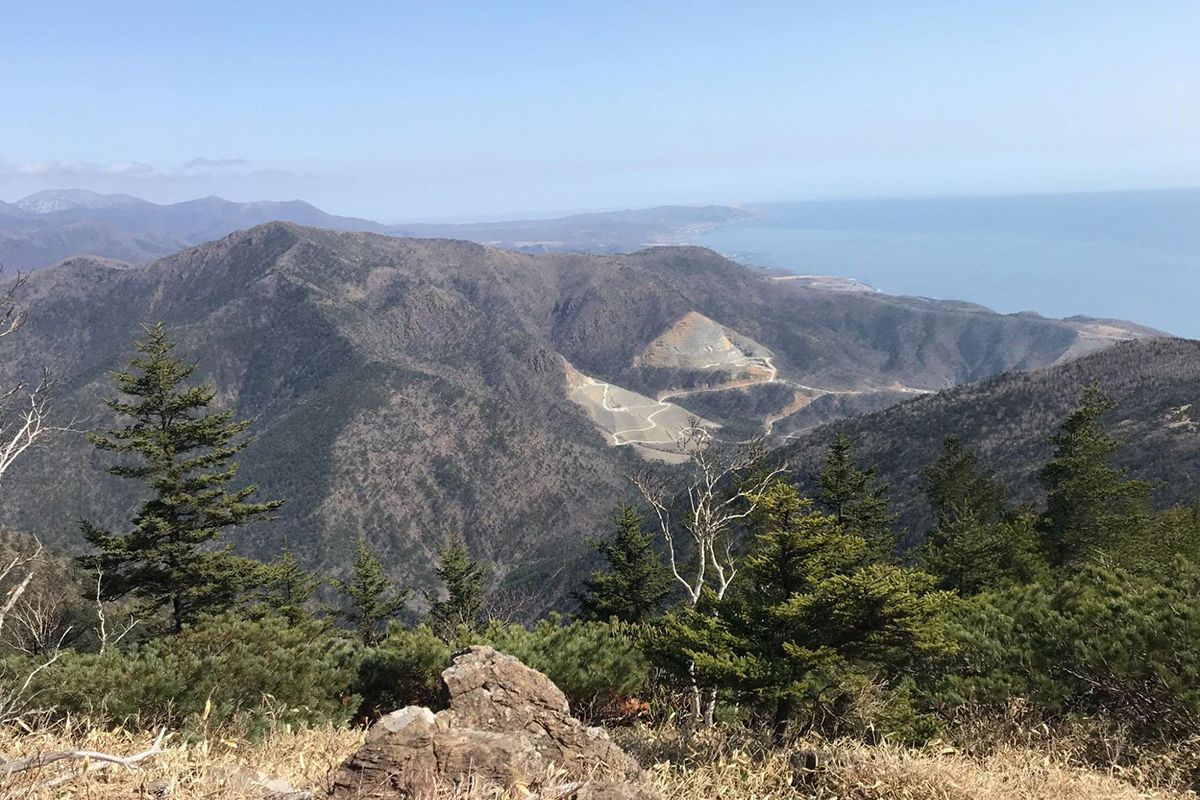
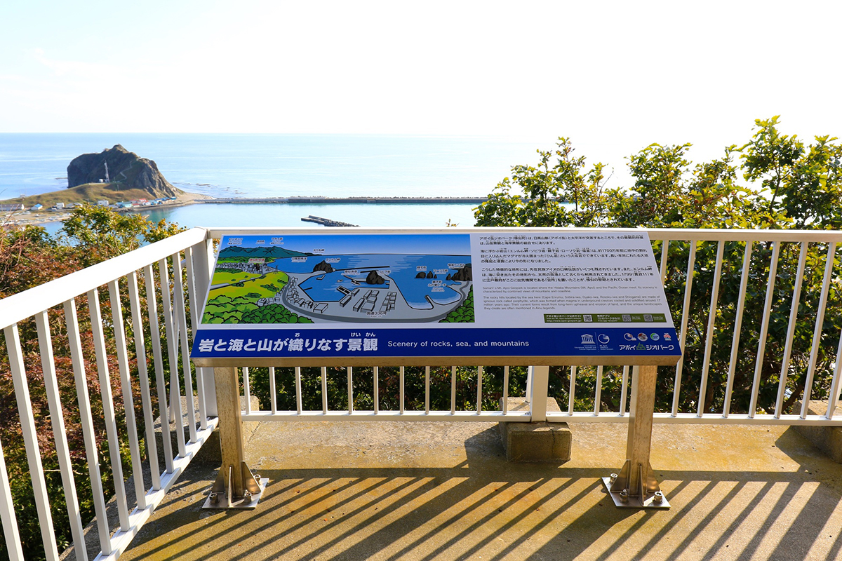
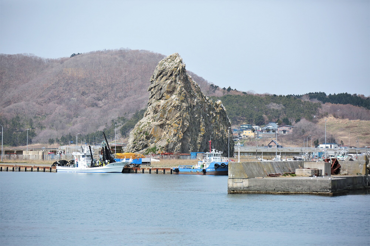
One point that we definitey want to mention about the Samani coast area is “Cape Enrumu.” This place was originally an island, then sand collected and connected the shore with the island and is now called, “land-tied island.”
Cape Enrumu”s Observatory is a special and quite a popular viewing spot with sweeping views of Mt. Apoi, Pinneshiri, downtown Samani and far off in the distance, Cape Erimo.
Furthermore, from long ago the area was considered as a convenient harbor as the shape of Cape Enrumu made it an easy place for boats to anchor. It is said that the existence of Cape Enrumu is what later connected Samani to its development.
For those interested in geology and rocks, let’s have a look behind the scenes of the cape. You can see the “joints” where the magma cooled down and solidified. In summer, there is kept being dried near the joints. It’s safe to say that the sight of kelp and joints coming together is unique to Samani Town.
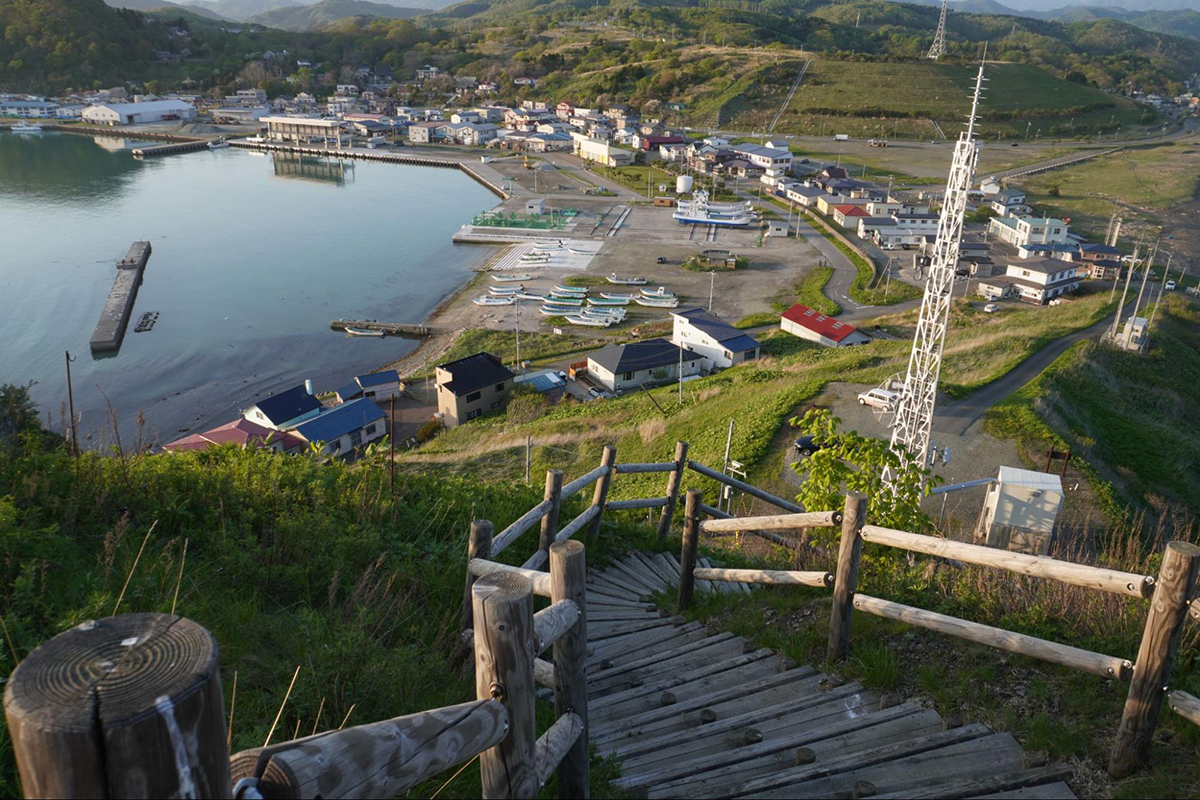
Mt. Kannon is one of the best viewing spots for overlooking beautiful landscapes from the mountains. The view from the observatory is exhilarating with Samani’s fishing harbor stretching out just below. In winter, the surrounding trees loose their leaves creating an increased sense of space. In contrast to the summertime landscape, winter is also breathtaking with a completely different white scenery worth seeing.
In spring, you can find healing in the beautiful flowers that color Mt. Kanon, blooming one after another. Flowers such as, Corydalis ambigua, Anemone raddeana, Dogtooth violet and Trillium camschatcense. We recommend this spot not only to locals, but to tourists as well.
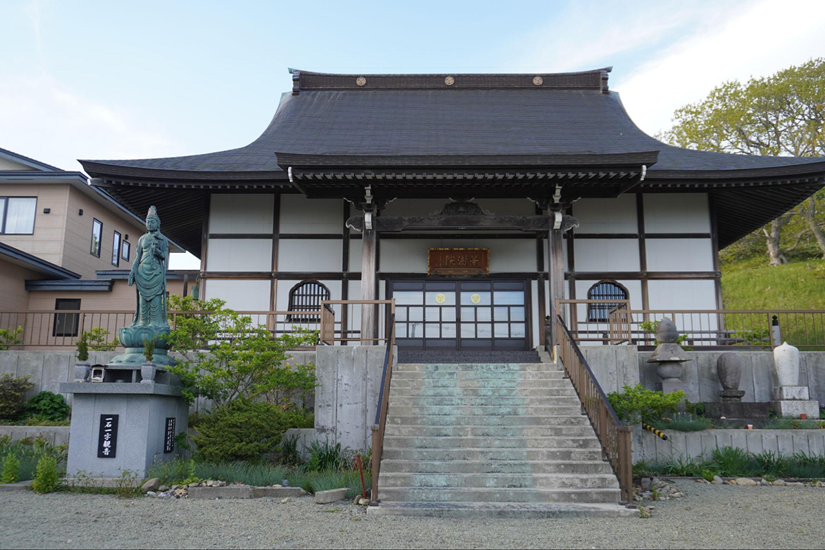
The name Mt. Kannon comes from the restoration of a Buddist temple in Samani Town (Tojuin), when the 13th chief priest installed 33 Kannon statues. The Kannon statues surrounded by lovely flowers in spring are also worth seeing.
Furthermore, at Kannonyama Park there is an old historical oak tree (big Japanese emperor oak) and an Ainu fortress that Hokkaido takes great pride in. Be sure to check these out too.
Enjoy strangely shaped rock art and natural formations
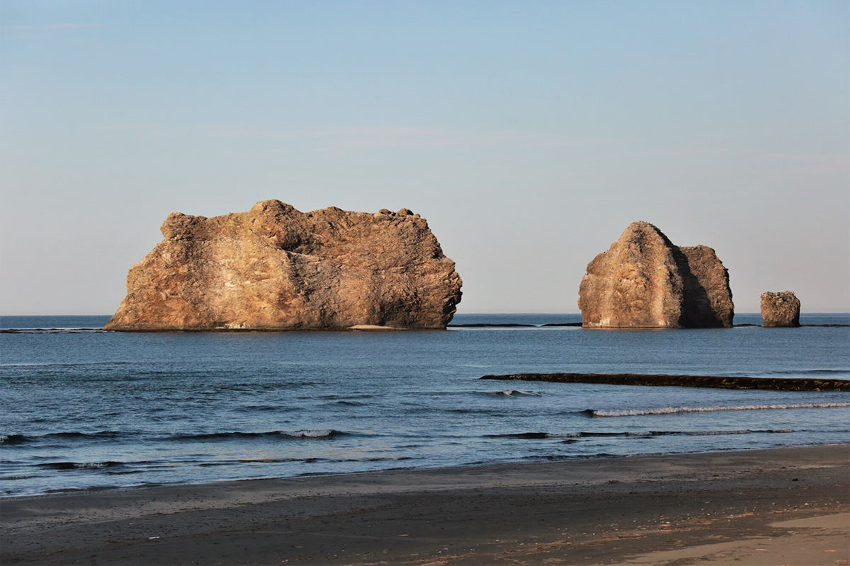
Strangely shaped rock art is one of Samani Town’s scenic characteristics. Huge peculiar shaped boulders are scattered about, with each one having a name and a story to tell.
The most famous is the “Parent and Child Rocks.” There are 3 boulders of different sizes lined up, which look like 2 parents and a child. This rock formation has become the symbol of Samani Town. The scenery is especially picturesque when the evening sunsets between the rocks, which is a rare site that can only be seen during a specific period in winter.
At the Parent Child Rock Fureai Beach you can enjoy viewing the beautiful Parent and Child Rocks while swimming in the ocean. The beach is fully equipped with showers and flush toilets and is quite a popular spot within the Hidaka region, with many people coming to swim in the ocean in summer. You should try visiting the area and make it one of your wonderful memories in Japan.
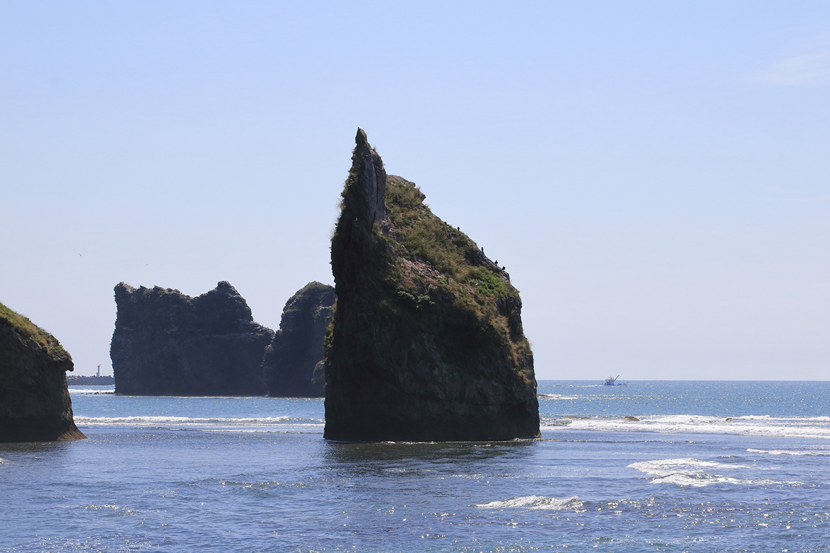
Also, if you look on the east side of the Parent and Child Rocks, there is a rock called, ”Sobira Rock.” It’s quite a unique site as a huge boulder that stands alone in the fishing harbor.
There is an Ainu legend that is related to a parent and child resembling the Sobira rock and the Parent and Child Rocks. “Long ago, there was a battle and the chief of the village that lost tried to help his wife and child escape. However, the wife made it to Samani and felt that she could no longer run, so she held her child tighlty, entered the ocean and became a rock. They became the Sobira rock (just east of the Parent and Child Rocks).
Shortly after, the chief who followed his wife saw the rock and he also entered the water and transformed into a large rock just to the west of the Sobira rock. When the chief enemy saw this he felt extremely frustrated. He then shot a Japanese mugwort arrow towards the big rock, breaking it into 3 pieces which became the Parent and Child Rock formation.”
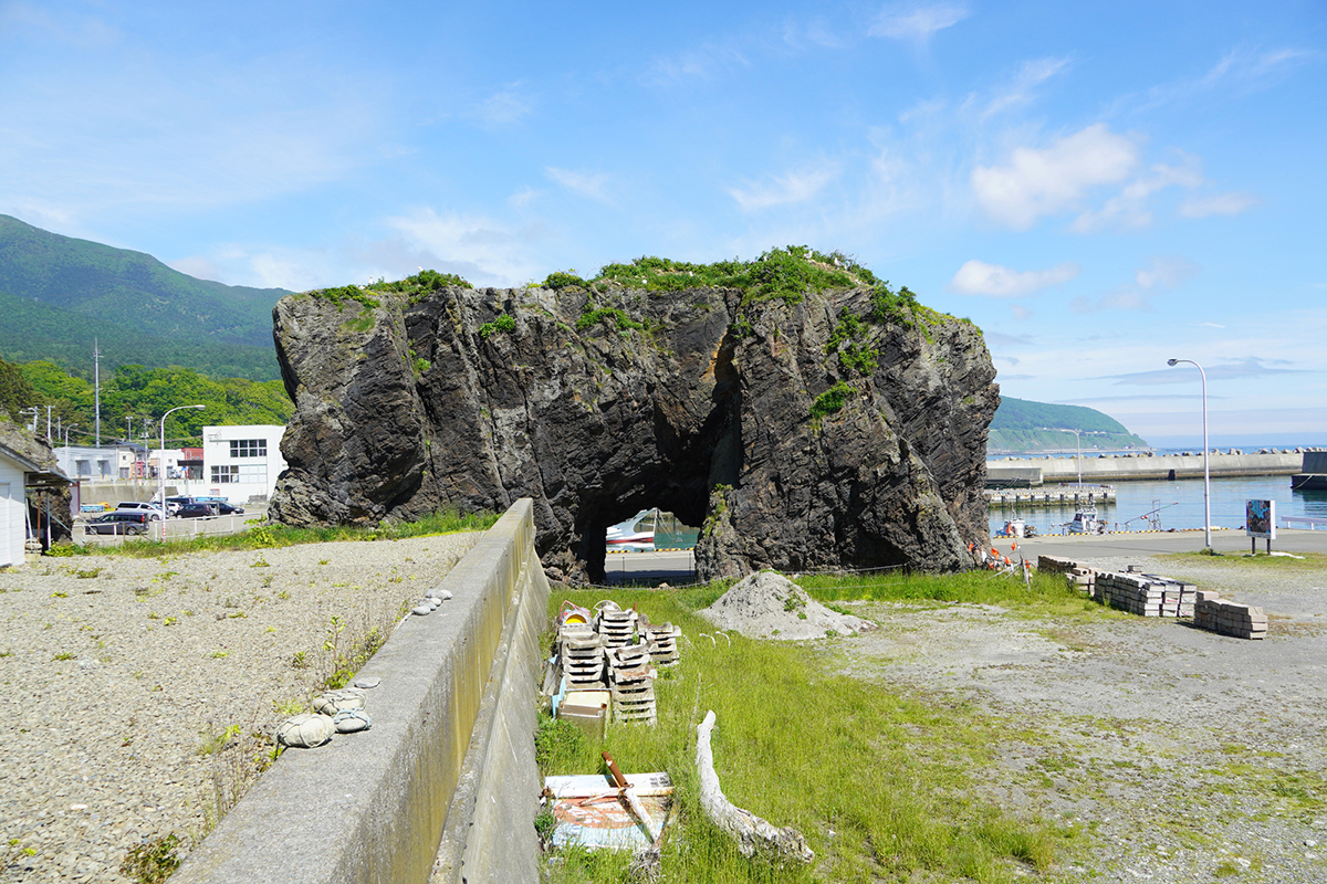
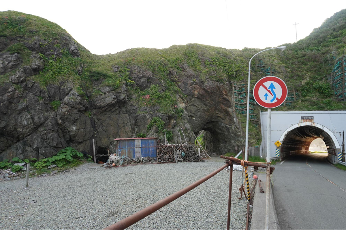
Also, we can’t forget about the Shiogama Tunnel and the Candle Rock. The Shiogama Tunnel’s name was derived from the fact that it was in the neighborhood of the first salt making place in Hokkaido. The large rocky mountains surrounding the tunnel were formerly used as Samani’s gateway.
“Candle Rock” is a huge rock located beside the tunnel. According to the Ainu legend, Candle Rock is a whale skewer that the Gigantic Ainu God (founder God of the Ainu) dropped.
* The tip of Candle Rock was originally pointed-shaped, however it collapsed during an earthquake.
Also, there is an indented area on the mountain side of the Shiogama Tunnel that is said to be where the Gigantic Ainu God once got surprised and fell on his behind leaving a mark. Quite an interesting and careless God, wasn’t he.
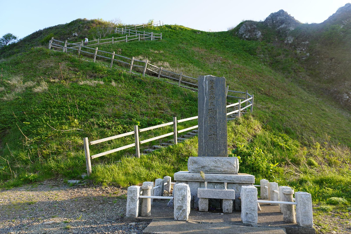
Lastly, the Samani coast area that we introduced in this summary has one more spot worth seeing. Let’s have a look at the footpath that goes around the area. It’s about a 10 kilometer course that takes about 3 to 4 hours to make your way around Cape Enrumu, Mt. Kannon, the Parent and Child Rocks, Mt. Kannon’s Observatory and the Tojuin.
On the way, if you look out towards the ocean from Mt. Kannon, you can see the sites mentioned earlier, including the Candle Rock, Parent and Child Rocks, Sobira Rock and Cape Enrumu all lined up off into the distance. These rocks were all created around 17 million years ago when cracks in the earth allowed for the underground magma to ascend, which then cooled and hardened into what it is today. When visiting this site, you can get a feel of the earth’s ancient existence.
Please come and get a feel of the earth’s history, Ainu legends and Samani’s nature while looking out from the Apoi mountain range.
Precipitous Cliff Scenery “Hidaka Yabakei Area”
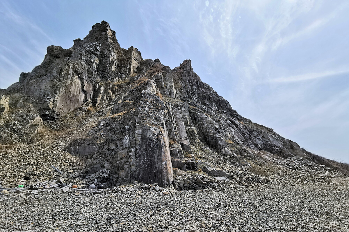
Feel the natural formation and the earth’s drama in the precipitous cliffs
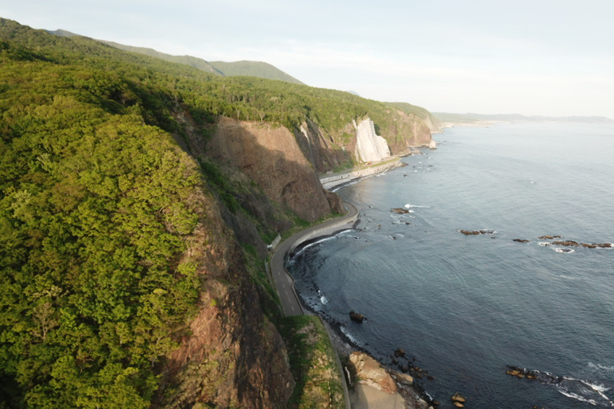
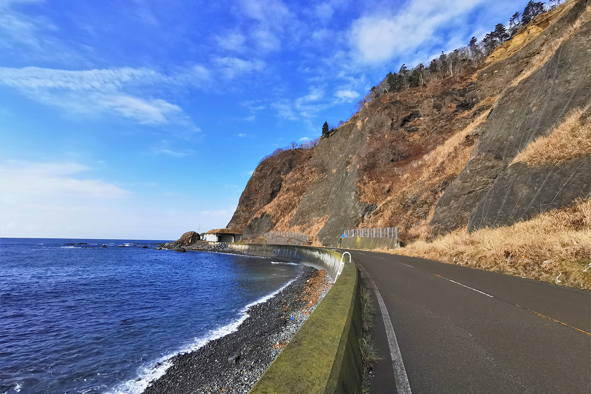
Hidaka Yabakei is a coastline area with precipitous cliffs that rise perpendicularly with heights reaching up to 100 meters, stretching out for about 7 kilometers. The massive cliffs that nature produced are overwhelming and have been feared as a rough spot for commuters since long ago.
However, there are certainly benefits from the cliffs. Within the Hidaka coastline zone, Hidaka Yabakei is considered as an area where high quality kelp can be gathered. It is believed that the iron composed of peridotite, the Magnesium and the minerals have a great effect on the quality of the kelp. By sun drying the kelp on the same day it was gathered over a peridotite drying space, high quality kelp which constitutes the foundation of Japanese cuisine can be created.
Furthermore,there is an exclusive hole-in-the-wall surfing spot known by very few. Due to the geographical features, the waves break easily and consistently and aren’t really affected by the winds. Many surfers from Japan and abroad who are looking for beautiful waters and scenery visit the area between May and November. If you’re interested in enjoying surfing in Samani Town, let’s stop by a surf shop and gather information on the dangerous points and the local rules.
The precipitous cliffs aren’t the only highlight in Hidaka Yabakei. Here, we will introduce a beautiful yet terrifying spot created by nature.
There is one spot definitely worth pointing out. In Yabakei, there is a giant rock with a hole in it called,”Fuyushima no Anaiwa (Rock with a hole).” The place name Fuyushima derives from the Ainu terms “puy” (hole), “o” (there), “shuma” (rock). The hole was not created by people, it is called a “sea cave” and was formed as a result of wave erosion. A famous explorer from the Edo Period, Takeshiro Matsuura, as well as other travelers, left recordings and poem compositions about the massive hole, making it apparent that this place was considered quite impressive since long ago.
About 13 million years ago, 2 of the earth’s plates (big planks that touch the earth’s surface) collided, creating Mt. Apoi and the Hidaka mountain range. This is the actual spot where the “former plate boundaries of Fuyushima Ooma” created the Hidaka mountain range. The actual plate boundaries are parallel to the Hidaka mountain range covering a distance of about 140 kilometers. The ground level areas that are open for observation are quite restricted as the region is considered as an extremely rare and valuable scientific site.
The rare occasion that 2 completely different rocks are neighboring each other on the same coast is quite unique and has become a legend of the earth’s ancient times.
The plate boundary is an interesting geographical feature where you can see a deep ditch along the coast when the tide is out. Let’s keep the timing of the low tide in mind and go have a look.
Lastly, we would like to introduce the Taisho Tunnel. The tunnel was given this name because it was dug out during the Taisho Period. As a spot with many large rugged rocks protruding from the ocean, it was considered a rough area for commuters while also being the largest obstacle in Samani. In order to pass through this rocky area, there was no other way than to aim for the instant when there were no waves, then rush your way across, which as you can imagine created distress for travelers. In order to avoid such dangerous conditions, one by one tunnels were dug out starting from the Edo Period and continuing through the Meiji, Taisho, Showa and Heisei Periods. There are currently 3 completed tunnels.
Follow the history of the Edo Period on a Samani mountain path
Around Yabakei, there are massive boulders and precipitous cliffs, which hindered pathways and caused distress to travelers. Without a path to take, people were forced to run through the coast and scale cliffs. The history behind the plan to create the “Samani Mountain Path” was to give travelers a detour to get around.
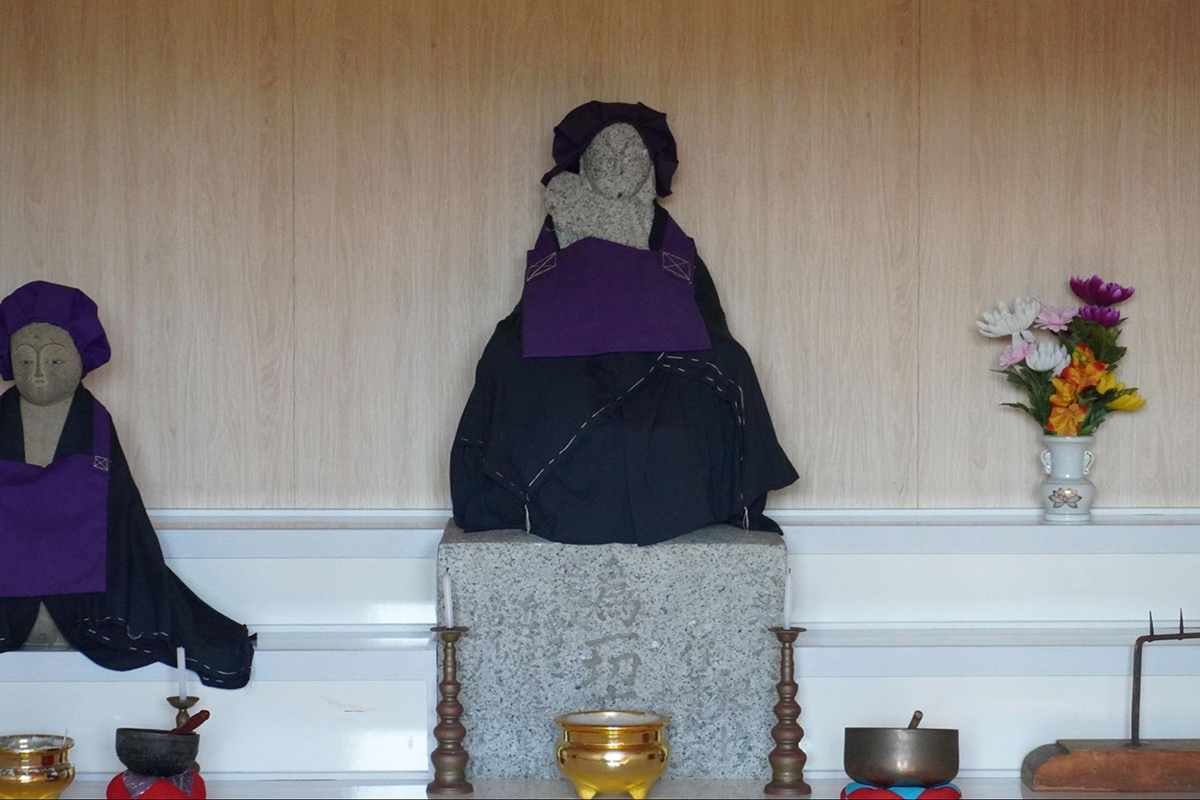
The Samani Mountain Path was created during the Edo Period with the purpose of strengthening the defense for “Ezo” (Hokkaido’s old name). It was because of the efforts of a man named Wasuke Saito that the path was constructed and is now worshiped as Wasuke Jizo.
The current Samani mountain path has an over-all length of about 7 kilometers and is a footpath course that takes about 4 hours to cover. It’s a preserved historical heritage site of Samani and was selected by the Agency for Cultural Affairs as one of the “Top 100 historical roads.”
This path created by the Edo Shogunate, allows for people to now walk along while being fulfilled with Samani’s history and nature. We recommend touring this path as you’ll be able to see many interesting sites, such as the Wasuke Jizo, breathtaking cliffs, the Taisho tunnel and more. Please remember that stamina to some extent will be required as the footpath does have some ups and downs, as well as mountain stream crossings. You’ll also need to dress in clothes suitable for mountain climbing.
Autumn Leaves and Fishing “Horomankyo Area”
The picturesque scenery of Horomankyo
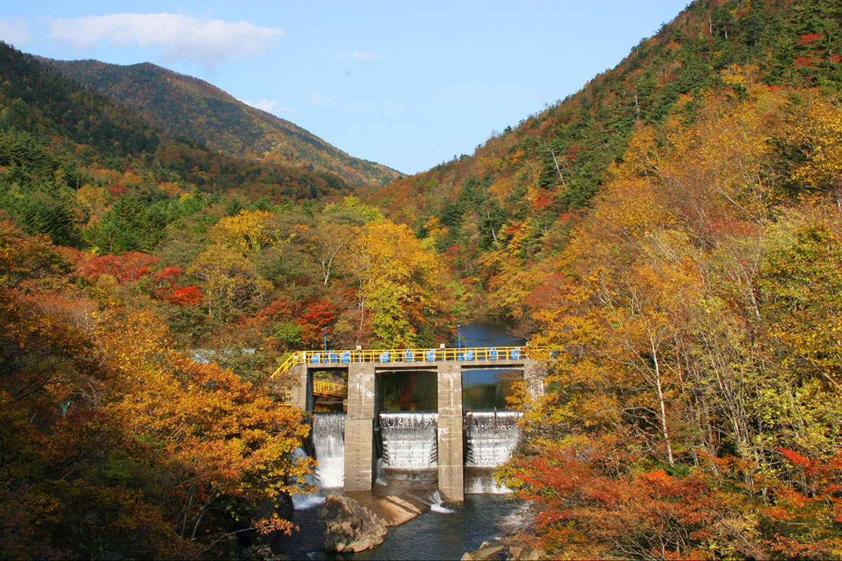
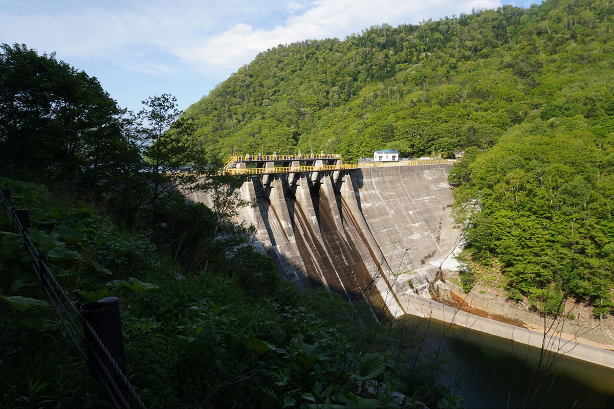
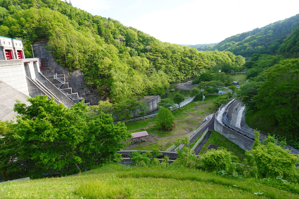
Horomankyo is a peridotite gorge about 8 kilometers long located on the east side of Mt. Apoi. At the last stop of Horomankyo is a hydroelectric power generation damn that was established in 1954 called, “Horoman Damn.” Here you can enjoy a gorge that was made beautiful by the multi-colored peridotite.
Around the end of October is especially a good time to see the beautiful autumn leaves. It’s a hole-in-the-wall spot we recommend as it’s not that well known even within Hokkaido. At each scenic point, there are places to park your car making it easy get out, take pictures and enjoy the scenery during your drive. Horoman Damn is known for having the largest capacity of storage water in Japan for a damn owned by a private company.
In front of the Horoman Damn is a red shrine gate marking the entrance to the Horoman-gawa Inari Shrine. The temple was built along with the construction of the hydroelectric power station. Next to the shrine gate are remains of the first hydroelectric power station in the Hidaka area. Please have a look and enjoy a glimpse of the past.
If you have some spare time, try stopping by the riverbank. While being careful and observant with every step you take, you’ll come across cylindrical holes that can be seen between pure white rocks. The rocks are plagioclase lherzolites and the holes are called “pot holes.” The holes are formed by little stones getting caught in the crevices of the rocks and the water that flows over them creates a kind of drill like effect.
Horomankyo’s nature and fishing
If you continue past the entrance of Horomankyo on the forest path, you’ll come across a monument on the roadside known as the “Japanese White Pine Monument.” The Kitagoyo Trees cover the mountainside across the river, and in 1943 the stone monument was recognized as the northern limit of their habitat and was designated as a Natural Monument of Japan.
If you head down the riverbank, you will come across a beautiful gorge of peridotite. You can experience extraordinary geology and get a feel of Horoman’s peridotite beneath your feet that was formerly over 50 kilometers below the ground. Being surrounded by the beautiful scenery and the majestic geological history will surely set you free of any worries you may have.
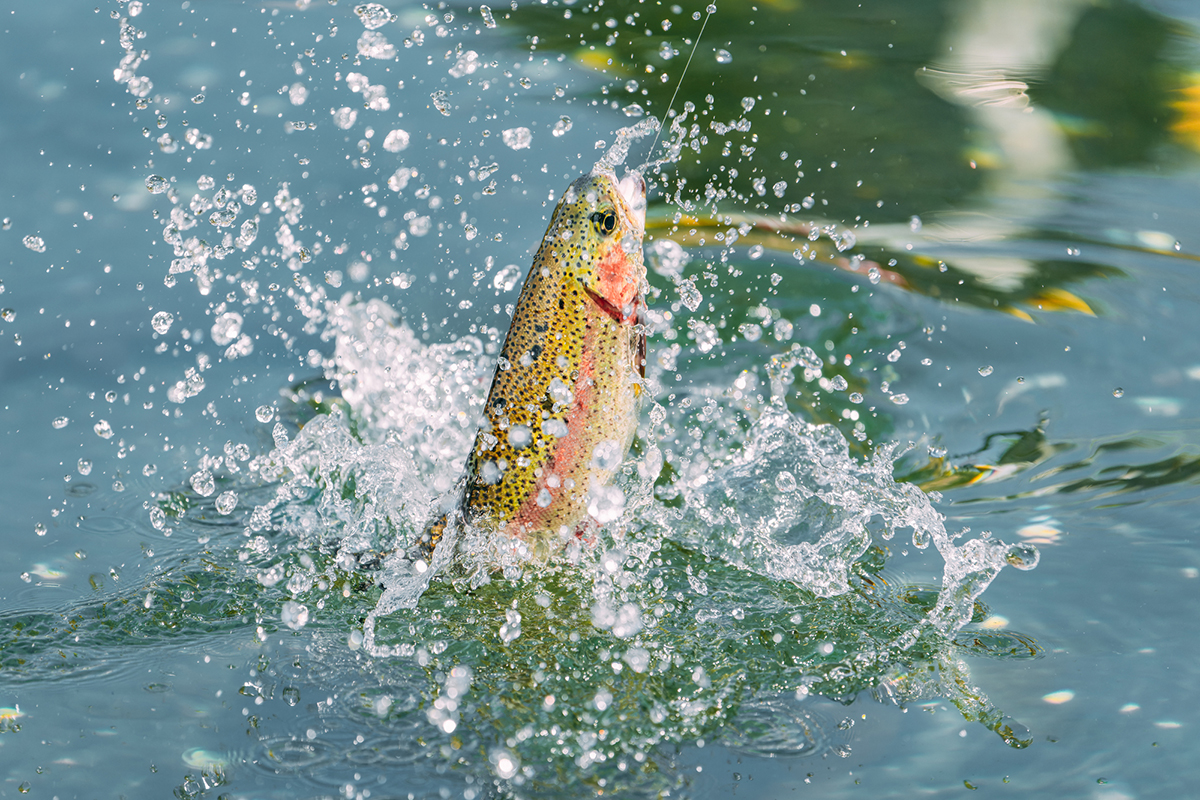
You can also try river fishing around the Horoman Damn. Upstream you can catch rainbow trout, Japanese char, landlocked masu salmon and can even enjoy it fried. However, please consult with a travel agency beforehand as you’ll need to purchase a fishing permit in order to fish in the area.
Geology traveling from the southern oceans and Samani’s cherry blossoms “Shintomi area”
Geology from the southern oceans to the northern land
In the Shintomi area, you can see spectacular geological formations that made their way over a great distance from the southern oceans to the northern land of Hokkaido.
One is the Matsuokasawa limestone block. Limestones are rocks made from coral reefs formed by accumulated remains of seashells that have hardened on the coral. Try looking for clusters of white limestones that were left from the former limestone mining days in the Shintomi area.
There is also a rock called, “chert,” that used to sit on an oceanic plate from the southern sea. It’s quite a hard rock made by radiolarian (a kind of plankton) and sea sponges that submerged and settled at the bottom of the ocean. It’s said that you can even create sparks when hitting it with a hammer.
In the Shintomi area, you can see a side of the earth’s long history and experience geology that took an eternity to reach the northern land of Hokkaido.
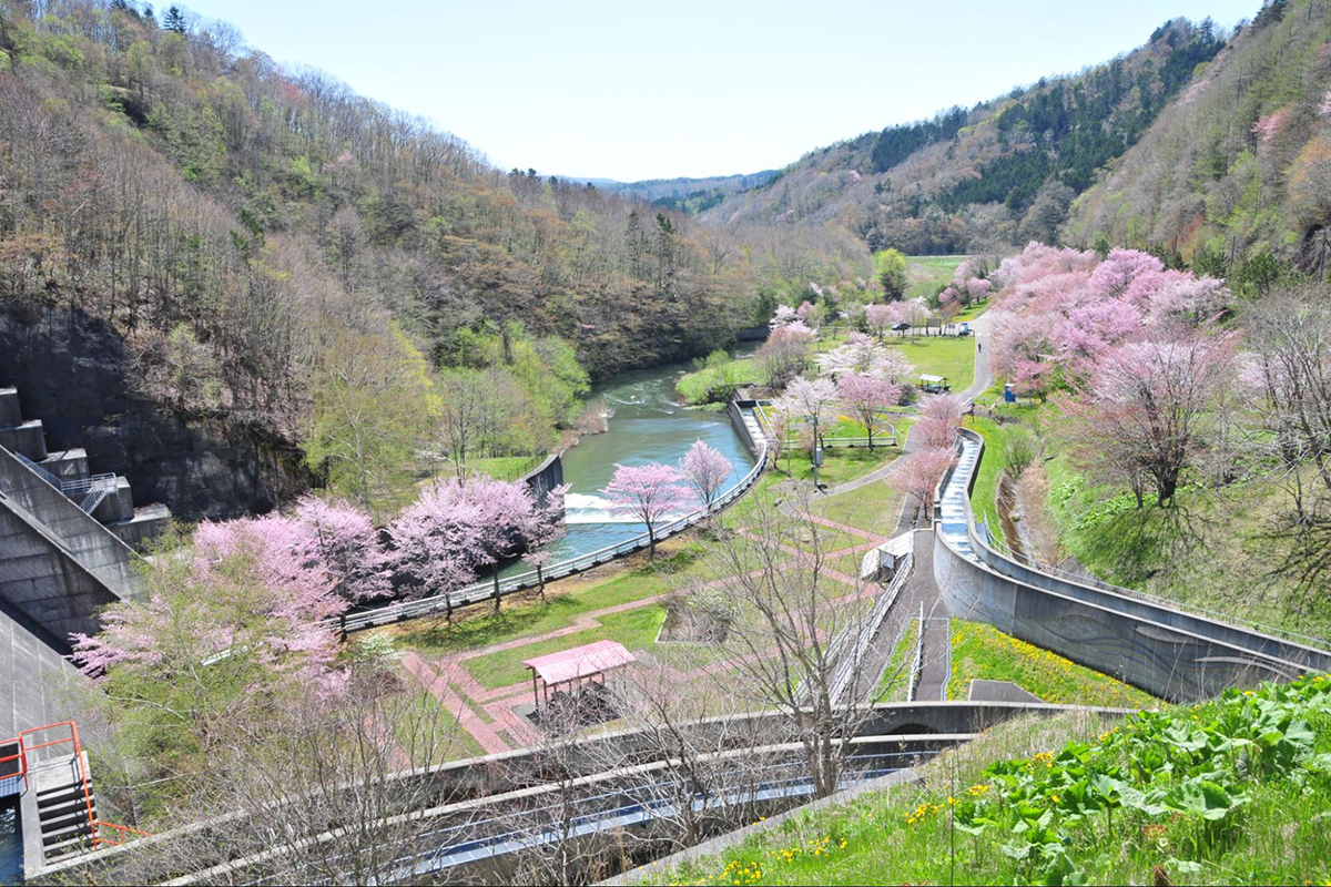
Samani Damn Campsite, a famous hidden spot with cherry blossom trees
In the Shintomi area there is a place called, Samani Damn Campsite. Other than camping, you can also enjoy river fishing, and possibly catch carp and rainbow trout upstream, and Japanese dace downstream. Although there are easily accessible toilets in the area, the tap water is non-drinkable, so please remember to bring enough drinking water if you decide to go camping.
Around the Samani Damn is a spot surrounded by cherry blossom trees. It’s located just 15 minutes away by car from the downtown Samani area, which makes it conveniently nice and easy to access.
* The area closes around June due to landslide danger.
In this article we introduced Samani Town’s most attractive sites and characteristics of the UNESCO Global Geopark “Mt. Apoi.” The Geopark is the symbol of Samani Town. We also introduce how Mt. Apoi consists of 5 areas, each with legends of people and nature and recollections of hard times from the past.
Samani Town has many places worth seeing that couldn’t all fit into this article. We hope that you can visit Samani in person and be fulfilled with the breathtaking scenery. This is a Global Geopark that was authorized by UNESCO, which guarantees beautiful nature, scientific value and deep history.
One characteristic that makes Samani Town so attractive is that it can be enjoyed throughout all 4 seasons. With alpine plants blooming one after another from spring to fall, swimming in the ocean and surfing in summer, fishing and beautiful autumn leaves in fall, the sunset over the Parent and Child Rocks, Mt. Kanon and in winter the spectacular views of the snow covered Apoi Mountains, there are wonderful memories to be made no matter when you visit.
In Samani, Hokkaido you can enjoy learning about the history of the earth and make visiting the Geopark the main part of your trip. Or you can focus on cherishing the gem-like alpine plants. Others may choose surfing, fishing and other activities as the main part of their trip. Whichever you decide to plan as the main part of your trip you will surely have a fulfilling and satisfied experience.
Just as we introduced in this article about Samani Town, there are many ways to have fun and enjoy the area. Because there are so many options, you may get a little puzzled when creating a plan. We recommend consulting with our professional travel agency as we can help you design the most suitable trip that will create lasting memories for your family and loved ones.
Please feel free to consult with us at Hokkaido Treasure Island Travel Inc. We will design a wonderful tour or itinerary in accordance to your requests. Please don’t hesitate to click on the “Contact Us” link below for further inquiries.